Showing posts with label Trail Report. Show all posts

Tuesday, July 13, 2010

Tuesday Trails: Book Review - Minnesota Running Trails

Hello loyal Tuesday Trails readers! I'm still recovering from my light ankle sprain, and while I ran Hyland and Lebanon Hills this past weekend, overall, I've been doing less mileage as I try to heal. Less running = more time for reading! And so that makes this the perfect week for the first (and probably last) Tuesday Trails Book Review! (my English teacher would cringe at that transition).

I counted 9 Minnesota trail books in my own library (7 of them pictured above)
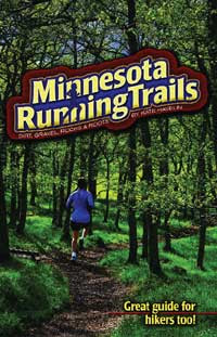
There are many guidebooks to trails around the state of Minnesota. Some focus on certain regions (North Shore, Metro Area) while others look at the most popular trails around the entire state. A quick search on Amazon found that most focus on hiking (69), some on walking (which may be different than hiking?), some on cross country skiing (21), several on bicycling (9), but there's only one guidebook that is dedicated to the trail runner.
Truth in advertising, it IS a great guide for hikers too
"Minnesota Running Trails", by Kate Havelin, a St. Paulite, is the only book that I've found that gives trail reviews from the perspective of a trail runner. You may be wondering why that is important distinction from "hiking". There are at least 2 major differences in running and hiking reviews:
  1. Distance. This is the big one. To a day hiker, 5-6 miles is a nice, long hike, worthy of a trail review. To a trail runner, 5-6 miles isn't worth the drive. We're looking for 8, 10, 15, 20+ miles of scenic trails.
  2. Surface. A rooted and rocky surface on a trail may not even warrant a mention in a hiking trail review, but that is an important feature for a trail runner. 2 years ago, after reading a hiking trail review of Cascade State Park on the North Shore, I decided to check it out. I found much of the trail unrunnable due to the heavy roots throughout the trail, while just a few miles away, the state parks were just as scenic, without all the ankle-turners. (Confession, I'd run Cascade again, it just would have been nice to know about the trail surface ahead of time.)
"Minnesota Running Trails: Dirt, Gravel, Rocks & Roots" was published in 2006. A disclaimer on the inside reminds the reader that they are to run trails "at their own risk"! I'd add that we are to run trails to our own enjoyment as well! I picked up a copy of this book 4 years and have used it several times.

The book (like most guidebooks) is organized geographically: North Shore, Headwaters (Itasca area), Red River (NW MN), Prairie (SW MN), Bluff (SE) and Twin Cities trails. As with most guidebooks, the North Shore and Twin Cities areas have the most trails listed, with 13 and 15 respectively.

Each trail review starts out with the basics: Mileage, surface type, hilliness, races, directions, other uses for the trail, and directions. While Kate then suggests a single route for the park, there are often many other routes in the parks too. Those extra routes are shown on the map, but not specifically reviewed. For the selected route, the book gives pretty much a turn by turn review of the park. Kate ends each chapter with her personal reflections on the trail.

My favorite part of the book comes at back of the book. Each trail has a small index card that can be cut out and carried on the trail during the run to help with directions. My biggest frustration with running unfamiliar trails is getting lost or the fear of getting lost, which causes me to stop every half mile at EVERY trail map and reassess my location. I can't count how many times I have stared at a trail map online for a new park, trying to memorize 8 different turns so that I only run 15, not 50 miles. Usually by mile 5 I miss a turn and have to readjust. Running blind like that can be fun when that doesn't result in running way too long, or when one has enough time to get lost. Unfortunately. I don't usually allow myself enough time to get lost. I probably should simplify my life a little, but that's a topic for another blog post!

Tear-out, turn-by-turn directions set this book apart from all other guidebooks

As I eluded to above, one thing that really sets this book apart from the other guidebooks I have is that these are running routes, not short hikes. I understand that the hiking guidebooks are trying to serve a larger market of hikers with all levels of abilities, but even when I'm out for a hike, I don't care about the 0.8 mile round trip route from the parking lot to a waterfall overlook. I want a substantial hike/run with some challenging terrain. So whether I'm running or hiking, I use Kate's book to help plan the route. I may modify her route when I want to run a little longer, or cut a bit out if I'm out for a hike, but her suggestions are the best first cut at routes I have seen.

If you want great trail reports that are perfect for running (or hiking - I've given this book as a gift to hikers too), you can't do better than "Minnesota Running Trails". It is far better than any other trail guidebook I've seen, and is a more consistent and comprehensive resource than anything I've seen online, including this blog (OK, ESPECIALLY this blog).

There are only a few things I will caution you about regarding the guidebook:

  • The book is REALLY light on trails in southwestern and northwestern Minnesota, so if you're specifically looking for trails in that area, you may be disappointed.
  • The book has only one edition that I'm aware of, so some trails may have changed slightly since 2006 when the book was published. I know that the Africa Loop at Afton has changed some and the directions in the book aren't exactly as you will find them at the park.
  • The book doesn't review every trail in every season. For example, there may be times (spring) when a trail is waterlogged, but Kate may have reviewed the trail in late summer and so all trail conditions may not be in the book. I know that 4 years ago I used the book for some runs on a camping trip to Itasca State Park over July 4th weekend. I was not prepared for the apocalypse being ushered in by biting, black flies. Obviously, the book doesn't cover every possible trail condition.

Do yourself a favor and pick up a copy! I know Amazon, Borders, and Barnes and Noble have them. I've seen copies at running stores too. Maybe you can even get a signed copy like I have!

Enjoy the trails!

Tuesday, July 6, 2010

Tuesday Trails: Afton 25K Race Report

Happy (belated) Independence Day! What did you do with your extended holiday weekend? Did you shoot off fireworks? Watch fireworks? Roast a pig? Read the Declaration of Independence?
With my extended weekend I decided to run the longest trail race I've competed in to date: the Afton 25K in beautiful Afton State Park. The race was held Saturday, July 3 in conjunction with the Afton 50K. I opted for the shorter distance.

Beautiful Prairies and Wildfires Steal the Show in Afton

I have run at Afton a few times and I love it there. The rolling prairies, steep ravines and sweeping vistas of the St. Croix River are breath-taking. Their hike-in campsites are some of the best and most-remote feeling in the Twin Cities.

Here's my promised race recap:

I made a series of errors leading up to this race (errors I'm sure I'll repeat again). The first was that I ran a marathon only 2 weeks prior.

I set out for Afton with my lovely wife Friday evening to meet some non-running friends for some summertime camping. We hiked in the 1 mile of steep terrain with all our gear and set up base camp. I then realized error #2: I had neglected to read all the email communications and didn't realize that everyone else had dinner before we went to Afton. So my pre-race dinner consisted of trail mix and S'Mores. Not too far off from my normal dinner, actually.

Our campsite was at Mile 10-ish


So then my wife takes off to sleep in our comfortable bed, and I decide that sleeping under the stars sounds like a great idea. So while all my friends pile in tents, I stretch out to gaze at the sky. However, that was hard to do since my view was blocked by hordes of angry mosquitos. So I crawled deeper in my sleeping bag. Problem was, it was still about 80 degrees at midnight. I had to decide whether to A) Be cool yet eaten alive B) Avoid the bugs but roast or C) Crawl into a friend's tent. I chose B and roasted all night. In spite of that, I still woke up in the morning with my face covered in mosquito bites (including one bite INSIDE my mouth.) We'll call that collectively error #3.

Error #4 came moments later when I'm trying to put my contacts in and decide to use my friend's saline solution. Which turns out to be hydrogen peroxide. So now, I can only see out of one eye, and I have a race in 45 minutes!

I wince and jog down the hill to the start. I bump into some racers I know, and meet some others for the first time. Soon, we're off and racing!

I quickly settle in about 15th place or so and attack the hills. There's a TON of tough uphill in the first 5-6 miles, and this is where I excell. I attack the uphills, press hard on the flats, but then, the really, ridiculously steep downhills come.

This was WAY steeper than it looks in the photo, I swear!


Now people are flying by me on the downhills, and I'm passing them again on the uphills. For the most part, I'm coming out ahead on this, as only one person of many that I was playing leapfrog with beats me. Unfortunately, my timidness on the hills starts to quickly wear on me physically. By about mile 7 of gingerly stepping down the hills, my left ankle is tense and feeling sore. From then on, I'm practically walking the downhills.

At the 10.5 mile checkpoint, I'm around 1:15, a 7:10 pace. The next 1.5 miles are the flattest and straightest section and I start to fly again. I'm thinking that I have sub-2 hours in the bag! No WAY can I not break 2:00 with only 5 miles to go! In fact, with 3.5 miles to go, it's looking darn near impossible that I won't be breaking 2:00.

Well, hubris on a dreadfully hot day and on a ridiculously hilly course will come to bite you, and it did me in quickly. After mile 12, the race ascends from the river up the "Meat Grinder". I know this is bad, and I'm ready for it, and I walk faster than others are running. I'm still looking good.

Then I get to the last 2.5 miles of the course, a single-tracked, super hilly and twisty section in the SW part of the park. Again, I'm attacking the hills, but now there are no more flat spots to cruise, and the downhills are obscene and very dangerous. I am walking parts of EVERY downhill. At this point, honestly, I'm limping. My left ankle is hating me and I have zero stability.


That is not the facial expression of a happy finisher

I limp across the line in 12th place, just a few seconds over 2 hours. I grin through the pain and greet my friends who have come down from the camp to see me finish. Then I cheer on my other friends racing, grab the best tasting hot dog I've ever had and... start the sloooow walk uphill to get back to camp. (let's call that error #5).

MDRA's very own Andrea looks like she enjoyed this race WAY too much!


Highlights of the race include:
  • Seeing (at least) NINE hawks flying over the ski slopes around mile 3. Inspirational. At mile 14 they would have appeared to be vultures.
  • Cheering on the 50K runners. These are people who ran the same sick course I did and thought, "That was nice, how about another lap?"
  • Seeing my friends at the finish after I missed them by the campground because I thought I was faster than I actually was!
  • The AWESOME wicking race shirts that look like a concert t-shirt for a death metal band. My father-in-law thought I was pretty cool in that one.
  • Meeting a bunch of die-hard trail runners and getting a glimpse into the trail-racing culture that is quite different than the road-racing culture. The Finn-Sisu runners are awesome! If you're interested in trail running, check out their class!
  • Setting a PR at 25K, a PR for a TRAIL 25K and a PR for the Afton Trail 25K. The best part about racing trails like this is that no time is transferrable to another race. It's just you and the course. I'm hooked!

Sweet shirt! Rock on!


Lowlights:
  • Spraining my ankle. It's a mild sprain and you'll still be seeing me pound the pavement the next month or so, but I'm off of uneven terrain for at least a few weeks. Look for me, I'll be the guy running around the lakes in an ankle brace.
  • My downhill running is terrible. I lost literally minutes of time on the downhills and ultimately hurt myself by running tensed up. Any suggestions out there on downhill trail running form?

One last look at the St. Croix River! Afton SP, July 2010

Enjoy the Trails!

Tuesday, June 29, 2010

Tuesday Trails: Afton Trail Photo

Your Tuesday Trails blogger is taking the week off due to work commitments (this blog doesn't quite pay my mortgage. Heck, it doesn't even buy me a beer!)

Next week I will return with a race/trail report for Afton State Park. I'll be there to run the Afton 25K. Looks like there are about 80 spots left in the field, so hurry and sign up quick!
As promised, here's a photo. See you next week (which will probably be late as well due to the holiday!)

Afton Hills at sunset (taken by me in July 2008)

Monday, June 21, 2010

Tuesday Trails: Park (Minnesota) Point, Duluth, MN

Hello Minnesota runners! Like many of you (probably over 10,000 or so), I am sore and still tired from the Grandma's Marathon and Half weekend festivities. I ran the full on Saturday. I may not have had my best time in the race, but I had a great time over the weekend celebrating running and runners! It was a great weekend, and so much fun to cheer and support so many MDRA and other finishers.

So, like many of you, I'm not wanting to think too much about running this week, so I'm not up for a big trails blog post. So instead, I'll toss out a "trail" I've never run on, and see what you all think. I'm drawing my inspiration this week from Grandma's Marathon and this week's trail report takes us to Duluth: Park Point (a.k.a. Minnesota Point).


Background

My familiarity with Park (Minnesota) Point stems from many quick vacations over the years to Duluth. With its easy access from Canal Park just over the famed and historic Aerial Lift Bridge, Park Point is the logical place to go to access the rays and enjoy Lake Superior.

Park Point Beach is a great place to play in the sand and sun...

This past weekend the weather in Duluth was phenomenal! After the marathon we sloooooowly shuffled over the bridge and had a picnic on the beach right under the shadow of the lift bridge. We even walked in to ice our aching muscles.

...and an even better place to ice sore muscles after a marathon!
Sunday was even better! We drove back and went to a larger beach area and relaxed on the beach for a few hours, working out the singlet tan lines from the day before.

Park Point may be better known by the locals as a place for high schoolers to chill and start illegal bonfires. A couple years ago, post-Grandma's, we tried to do the same thing and were politely scolded by local cops.
Basics
According to Wikipedia, Park Point is 7 miles long on the Minnesota side, and 3 miles long on the Wisconsin side, making it the largest freshwater sandbar in the world. The beach really is spectacular and reminds me more of an ocean beach than a lake beach. I have been told that the entire beachfront is public access, in spite of all the homes that front the sand dunes.

This leads me to believe that at 7 miles in length, Park Point is a 14 mile round-trip beach run waiting to happen. I don't know about you fellow Midwesterners, but I LOVE running on the beach. I've run on beaches in California, Virginia, Argentina, Uruguay, Puerto Rico and Mexico. I have not, however, run on any beaches in Minnesota, mostly due to lack of length. Park Point seems an obvious place to beach run. Anyone out there try this?

Impressions

The beach is amazing, really reminiscent of ocean beaches. The dunes are beautiful and are undergoing restoration and revegetation. It's usually pretty windy along the beach, but this past weekend, there wasn't any breeze and the lake was the calmest I had ever seen it.
Race Venue?
I'm not sure there are any races on the beach itself, but apparently Grandma's sponsors a 5-miler on Park Point in July on the paved road on the peninsula. This year's race is July 16.
Whether racing, running or relaxing, Park Point is worth a visit!
Enjoy the trails!

Tuesday, June 15, 2010

Tuesday Trails: Lake Elmo Park Reserve, Lake Elmo, MN

First, a reminder to lend your voice to the Minnesota Trail Survey! Check out the MDRA website and click on the survey link in the upper right.

As promised, Tuesday Trails lands on the east side of town this week. This week's post takes us to Lake Elmo Park Reserve in Washington County right off of I-94.

This gorgeous park is about 15 minutes from St. Paul, and about 30 minutes from Minneapolis. It is definitely worth a drive, especially in the fall. There are probably 15 miles or so of hiking/running trails. They are grassed/mown trails that double as cross country ski trails in the winter (a common refrain for these multi-use regional parks.)


Background

I have met my running club out here a few times. Since it's one of the few parks we go to that charges an admission ($5 last I checked), we generally meet outside the park at a coffee shop and carpool in to save some money.

Every fall, I do work in Lake Elmo Park Reserve in my capacity as a water resources engineer, and that gives me free admission (and pays for the 30 minute drive across town), so I always make sure to bring my running clothes with me and when the work day is over, I change and hit the trails as the sun is setting.


Basics

According to Lake Elmo's website, there are 20 miles of trails. (The Winter Ski Map is much better than the Summer Map). At least 12 of those are soft trails. The western loop (A Loop) is a beautiful prairie loop. Other than the occasional McMansion sighting, the trail feels very remote. The B and C loops (central and eastern) are more wooded, although there are prairie sections as well. The terrain there is steeper and some portions of the trail near the Eagle Point Dam are quite eroded and could use some redesign using sustainable trail principles.

Watch out for gunfire on the eastern side of course! There's a shooting range there. I haven't been hit yet!


Impressions

There is no park in the metro that is prettier in the fall at sunset, in my opinion. The prairies are golden during the day, and turn a deep reddish gold at sunset. I just read "Prairie Erth" which is about the remnant tallgrass prairies of Kansas, and when I was reading the book, it was the prairies of Lake Elmo and Afton that I was imagining.


Getting There

The park is located a couple miles north of I-94 in the small city of Lake Elmo. From I-94, take Keats Avenue/County Road 19 north. Keats becomes the main park road. There's a park office where you have to pay (have exact change for the pay envelope). The main trail parking is about half a mile up on the left. If you pass the "Primitive Campground", you've gone too far! You'll know the Primitive Campground by the large protruding foreheads and usage of stone tools.

As far as I can tell, while there are other pedestrian access points to the park, there's no convenient parking at any of those locations. Best bet is to use the main entrance.

Race Venue

While the Ragnar Relay often uses the park as a checkpoint, very little of that race takes place in the park.

As far as I can tell, there are two races run in Lake Elmo. The first is the Lake Elmo Lions Huff-n-Puff 5K and 1/4 Marathon on August 14, 2010. 1/4 Marathon is an interesting distance. Some call that a 10K (with a short warmup). This race appears to be in the park, but on the roads. Price is pretty good: $12!

The second race in Lake Elmo uses the trails. The Wildwood Lodge Great Pumpkin Chase 5K and 10K will be run October 30, 2010. I've run this race before, and while I enjoyed the challenging routes picked (it's run on the hilly B and C loops), I did think that the race was slightly overpriced ($25 to $35), particularly since it didn't include the $5 park entry fee (and the shirt kind of sucked). I notice that this year the park entry fee is included, so it's a better deal now. I do wish more races had a cheaper option if you didn't want the shirt, but that gripe should be the topic for a different post! I may have to come back and give this race another chance. It's certainly run at the prettiest time to be in the park!

Enjoy the Trails!

Monday, June 7, 2010

Tuesday Trails: Elm Creek Park Reserve, Maple Grove, MN

We head back to a Three Rivers Park for this week's Tuesday Trail. (St. Paulites, don't worry, I'm headed your way soon). This week's report is on Elm Creek Park Reserve in Maple Grove.

Like most Three Rivers Parks, including the previously reviewed Hyland, Elm Creek offers something for everyone: hiking, biking, horseback riding, swimming, cross country skiing and more! You'll be surprised to learn that this post focuses on running the park's soft trails.


View Larger Map

Background

Growing up in the northern 'burbs about 11 miles from Elm Creek, I used to bike there with my family. I remember sliding down the zip line and swimming in the impossibly clean and huge man made lake in the park. In recent years, I've been back to the park for early season cross country skiing (they have one of the longest man made snow courses in the Twin Cities).

So this past week I headed back with some MDRA running buddies for my first summertime visit in nearly 20 years. Imagine my surprise that the huge man made lake of my childhood was in fact only about the size of 4 swimming pools! A part of childhood just died...

In any case, we had a fantastic trail run, so much so that I wanted to share the report with you all while it's still fresh in my mind. This is one park that is worth the drive!

Basics

According to their map, Elm Creek has over 50 miles of trails, the vast majority being soft trails. On our run, we covered about 15 miles of trails. We were treated to deciduous forestlands, native prairies and wetlands. Yes, lots of wetlands, so BRING BUG SPRAY!! The mosquitoes were thick every time we stopped for even a moment. There wasn't a lot of commiserating in the parking lot after our run.


According to their website, the park is building 12.5 miles of new singletrack trails for mountain bikers and runners using the sustainable trail design (Lebanon Hills in Eagan has the best example of this construction technique). This is exciting news and will definitely bring me back! Sustainable trail design in hilly terrains makes for a lot of long, rolling hills. It provides a better, more consistent workout and most importantly, better protects the trail from erosion and degradation.

Impressions

I really enjoyed the tranquility of Elm Creek. The trails were well maintained, like any Three Rivers Park, but with few park structures and no neighborhoods in sight, this park felt really remote. Only by the ski chalet and beach did the park have a more urbanized, sanitized feel.

I particularly enjoyed the dense forests and rolling terrain around Rush Creek in the middle of the park. The big northern loop felt most remote, and had some very challenging sections of rolling hills. Surprisingly good hill workout for a northern metro park!

Getting There

You can enter at the main entrance from Highway 81 by the chalet, but the preferred spot for trail running is the hiker parking lot on the west side off of Elm Creek Road. There's a small nature center there with bathrooms. You can even buy a T-shirt if you feel so inspired!


While parking at the hiker's parking lot, make sure to take time to check out this great perennial garden!

Race Venue

I'm not familiar with any races at Elm Creek, but Google is. There is a race Notes for Cliff 5K at the park next Saturday, June 19. Know of any others?

Enjoy the Trails!

Tuesday, June 1, 2010

Tuesday Trails: Fort Snelling State Park, Minneapolis, MN

This week's installment of Tuesday Trails brings us back to Minneapolis. "Really?" you may ask, "MORE soft trails in a the dense urban metropolis of Minneapolis? This cannot be!" Well, you're probably not asking that, but I'll tell you more about one of my favorite parks, Fort Snelling State Park. Before I write my report, I'd like to link to a trail report that my friend (and MDRA member) Nick wrote 2 years ago. He did a better job than I will, so you should probably just read his!
Background
Not that I mind being confused with my esteemed blogger colleague, Rocco, but apparently on last week's post, a couple of you thought I was Mike. That's ok, but I'm not Mike, and I doubt he wants to be confused with me. This confusion made me realize that I had not properly introduced myself, and this week's entry is probably the most appropriate one, as you'll see why in a moment!

My name is Nathan, and I am a board member of MDRA, and an occasional coach and team lead of the marathon training programs that MDRA offers. I moved here several years ago and within a week had bought a house in South Minneapolis, picking the location purely on my experiences during the Twin Cities Marathon in 2003. I knew I wanted to be as close to Minnehaha Falls as possible, so that's where I lived. I loved that spot with the access to Minnehaha Parkway, the River Roads and Lake Nokomis. What I didn't know was that my favorite running spot by my house would be an entirely different trail.

I had no idea Fort Snelling was so accessible to Minnehaha Falls and only discovered it by accident by running the wrong way down the long hill from the falls to the base of the fort. Once I had a taste of the trails down there, I was running down there a couple times a week, particularly on Pike Island.

I recently moved closer to Uptown, so I don't get back to Fort Snelling as often, and I really do miss it. In fact, I miss that more than anything else about my old neighborhood, with the exception of the 5am runs with Rocco. I know he doesn't miss those.

That's enough about me, on with the trail report!

Basics
Fort Snelling has an interesting, amazing, and mostly sad history. It's not important to know the history to run here, but it's important as a Minnesotan to know what took place here. The Minnesota Historical Society runs a nice museum on top of the bluff, and there are other resources you can find on the Internet as well to learn more. Here are just a few interesting facts about Fort Snelling:
  • Purchased by Zebulon Pike in 1805
  • Fort construction begins in 1820
  • Dred Scott lived here as a slave, and since Minnesota was a Free State, he used his time at Fort Snelling as justification in his unsuccessful attempt to win freedom through the courts
  • The largest mass hanging in US history was carried out here in 1862. Lincoln ordered that Native Americans suspected of being involved with the Sioux Uprising be executed. This is without a doubt the darkest day in Minnesota history


Most people experience the historical settlement part of Fort Snelling

In terms of running (which is why you're reading this), Fort Snelling offers about 10 miles of running trails, almost all of which are soft trails. The state park website has an excellent map that details all the trails here. This blog post will focus on the trails on the west side of the river, however, on the east side of the Minnesota River there are more soft trails, often called Sibley Trails due to their proximity to the historic Sibley House.

The 3 main features of Fort Snelling (for running) are Pike Island, Picnic Island, and Snelling Lake.

Pike Island
This is a gem and my favorite 3 miles of running in the Twin Cities. Many find it boring because it is so flat, but I like the familiarity of it. The island is precisely a 5K (3.1 miles) in circumference, with cutoffs to allow 1 and 2 mile loops as well. The trails are dirt and gravel, and very flat. The density of deer living on this island is rather extreme, but if you enjoy seeing wildlife while you run (like I do), Pike Island will not disappoint. Deer, cranes and beavers are everywhere on and around this island. You really feel far from civilization, which is ironic considering this was the site of the first permanent white settlement in Minnesota.


The bridge to access Pike Island

Picnic Island
It's not really an island since it is connected to the mainland by a narrow isthmus, but it probably used to be. There are picnic facilities and a boat ramp. This "island" is about 1.5 miles around or so. Not really worth it for it's own sake, but it's a nice way to make a trail run a little longer.

Snelling Lake
After Picnic Island you can continue running around Snelling Lake on the soft trails, pausing for a drink of water at the park ranger station. After completing the circuit around the lake, you're back at Pike Island!

Getting There
There are 3 ways to enter the park:

1) There's a 2-mile, paved trail that goes south from Minnehaha Falls down to Pike Island. Try to run easy down the trail, and hard back up! It's a nice shallow grade, so just perfect for that long hill workout.

2) Park in the lot up on top of the bluff for the Fort Snelling museum. It's free, and just a short, steep jog/walk down the bluff and onto the trails.

3) If you have a state parks sticker, you can park down below in the state park and run from there.

Getting Away
Fort Snelling is perfect for other add-ons. With its close proximity to 2 bridges (Highway 5 into St. Paul and Mendota into Dakota County), you have easy access to the River Roads, Minnehaha Parkway, Sibley Trails, and Big River Trail. It's a great spot to plan all or part of that 20-miler. Or it's a great spot to just run a 5K!

Race Venue
As I mentioned, Pike Island is exactly a 5K around, so it shouldn't surprise you to hear that races are run there! The Fort Snelling 5x5 Relay race every September is a favorite of mine. All you need are 4 friends who will run 5K! The race gets to be a little lonely in the latter legs of the relay, but it's still a ton of fun. This year's running will be September 19.

Enjoy the Trails!

Monday, May 24, 2010

Tuesday Trails: Hyland Hills Park Preserve, Bloomington, MN

This post is the second in a series of trail reports. The first report filed last week on Theodore Wirth Park, can be found here:


View Larger Map

BASICS

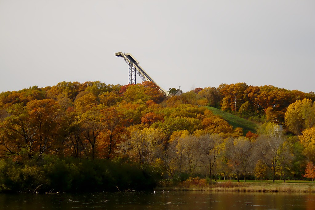
This week’s trail report takes us a wee bit further outside the metro to just barely outside the 494-694 loop in Bloomington, MN. Our journey takes us to Hyland Park Reserve, part of the Three Rivers Park System (formerly Hennepin County Parks). You may know this park as the place with the ski jump looming over Highways 494 and 100, but Hyland offers much more.

Hyland Hills features over 10 miles of soft, hilly trails, about the same amount of flatter, paved trails, ski trails, boating, fishing, Frisbee golf, and picnic facilities. But what concerns us most today are the soft trails.

IMPRESSIONS

Hyland, unlike Wirth and many of the other metro trail systems, feels utterly subdued. The trails are in excellent shape, provide challenging hills, but are so consistent and well-maintained that it’s almost like running on soft asphalt. For the user looking to escape civilization, Hyland doesn’t offer nearly as much as other parks, but for those looking to run on soft trails and get a great hill workout, it’s hard to do much better than Hyland.

That’s not to say Hyland feels like downtown Minneapolis or Uptown. Rather, almost every time I run at Hyland I see deer, wild turkey, turtles laying eggs, and I’ve even heard reports of a coyote. The park is big enough to support diverse ecosystems while still feeling like it’s just an extension of your backyard.

Personally, I love running at Hyland. The trails are familiar to me, the scenery is constantly changing, and the well-managed (and actively burned) prairies offer surprises on every visit.

GETTING THERE

While the main access to Hyland is on East Bush Lake Road at the southwest side of the park, accessing this location takes a long time, especially in traffic, and makes the park feel remote. A much closer (to the urban core) access point is at the northeast corner on Chalet Road, right next to Normandale Lake. The map below shows this access point and a suggested route.

Another benefit of accessing the park in this location is that for a short warmup or cooldown, one can run the nearly 2-mile flat paved trail around Lake Normandale. Just be warned that most of the trail is not lit.

The main loop (on the map below) is about 8.5 miles from the parking lot at Chalet Road. If you’re looking for more, you can add loops through the ski hill, or my favorite, taking the long, gradual path up to the top of the ski jump for incredible views of the entire metropolitan area. Rumor has it that Bloomington police camp out there on the 4th of July to make sure no one climbs the ski jump for an even better view of the fireworks. When I was in high school, I worked at a hotel across the street from the ski jump and we would watch the fireworks from 15 cities from the 22nd floor. It was pretty incredible. If you ever get the chance to watch the fireworks from the ski jump, let me know what it’s like!


RACE VENUE

Lastly, I’d like to mention that every April, Hyland Hills hosts a trail race, the Trail Mix 25K and 50K. I have not run it, but I’ve heard it is well organized and executed. Generally the course is still wet in April, so the race often will tear up the trails for weeks, if not months. Fortunately, the conditions were dry this year for Trail Mix and the trails are in fine shape! I just ran them last week and can vouch for the trail condition.

Enjoy the trails!

Tuesday, May 11, 2010

Tuesday Trails: Theodore Wirth Park, Minneapolis

Hello Minnesota Runners! This is a new feature that I’m calling, “Tuesday Trails.” Pretty creative, huh? Every week, or every other week, there will be a blog post on, you guessed it, Tuesday, and the topic will be… no, not Sudoku… the topic will be a trail in the Twin Cities. At some point I may expand the scope to Greater Minnesota, but you guys out there are so “Great”, you don’t need me to highlight all the awesome trails you have. Basically, I’m starting with what I know.

I’m beginning the series with unpaved trails, since the weather has been mostly fantastic and the trails are snow-free! This week’s trail report is a real gem: Theodore Wirth Park.


View Larger Map

Theodore Wirth Park is part of the Minneapolis Park System, yet actually resides in Golden Valley. Go figure. It has several distinct parts: Golf course, cross country ski trails, sledding hill, mountain biking trails, beach, and running/hiking trails!

Theodore Wirth Park was established in 1889 and was named Glenwood Park. (To see some really cool old photos, search for Glenwood Park at the Minnesota Historical Society’s website.) The park was expanded and renamed after the late, great Minneapolis Park architect of the same name.

There are over 700 acres of parkland and many miles of trails. So, where to run? To me, there are two principal options (please feel free to share your experiences below):

1) Connections to other regional trails: Grand Rounds, Luce Line and Bassett Creek Trails. Theodore Wirth runs mostly north-south and the paved trail that runs through it is part of the Minneapolis Grand Rounds bike trail, a 50+ mile loop around the entire city. Running on the rolling paved trails provides access to Minneapolis Chain of Lakes (by way of Brownie and Cedar Lakes) to the south and to Victory Memorial Parkway to the north.

Now that the Luce Line has fully connected to Theodore Wirth, from the paved trail, one can run west on the Luce Line out into Golden Valley, on to Plymouth and beyond, all the way to Lake Minnetonka. I biked on this recently and the new section of the Luce Line in Wirth is pretty nice. The only problem is that the very attractive pedestrian wooden bridge at the edge of the park is rather slippery in the morning dew.

Wirth also connects to Bassett Creek Trail on the east side of the park, which allows one to run toward the Bryn Mawr neighborhood, to Cedar Lake Trail and ultimately Downtown. This is a very pleasant neighborhood run.

2) Trail running in South Wirth: My favorite part of running at Wirth is the trail running! Who knew you could get some amazingly tough and beautiful trails and hills right in Minneapolis? OK, fine, Golden Valley. I live in Uptown, and within 3.5 miles of running from my house, I’m deep in the heart of South Wirth and hitting the hills hard. So where do you run? Looking at the map (south of Hwy 55), it doesn’t look like there would be a lot of mileage, but the Park Board has done a fantastic job of cramming a ton of trails into this small space without making it feel like they’ve crammed in a ton of trails.


The best map I've found showing the trails in South Wirth is the ski map.

There are two parts of South Wirth: Quaking Bog on the west side of Theodore Wirth Parkway, and Eloise Butler on the east side. Both have their unique challenges. The side that has Eloise Butler Wildflower Sanctuary has about 4 miles of trails (entirely outside the sanctuary). The course generally follows the cross country ski trails, with a few small deviations. The terrain is full of steep climbs and descends, and my favorite: a gorgeous section of trail through a coniferous forest glen that feels like Northern California. It’s hard to get the exact loop in Eloise down well. I usually just end up running there for a half hour or so until I feel like I’ve run out of trail.

After Eloise, comes the Bog. Quaking Bog, that is. The route in the Bog is well marked with ski posts, so just follow that main loop for a 2.5 mile time trial. Highlights include several tough climbs, a beautiful Tamarac swamp, and trying to run by the house with the constantly barking dog without waking it up.

The best places to access the South Wirth trails are from the parking lot off of Glenwood at the South beach at Wirth Lake or from the south by Brownie and Cedar Lakes off of the Grand Rounds.


There you have it! If you haven’t run on these trails, steer your car/bike/feet toward northwest Minneapolis for trail running in an urban setting!